The
David Rumsey Map Collection is a cartography web site that has an on-line searchable database.
An article in
Slate lead me to a section of 1880 maps communicable diseases, etc.
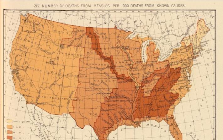
This next map shows the number of deaths in 1898 due to measles per 100 deaths from known causes,
with the following comment:
Quote:
While late-19th-century medicine didn’t yet have a vaccine for the disease,
doctors knew that it was easily transmissible. “Measles is a very infectious disease,”
warned Dr. John Dewar in an 1890 book written for mothers and titled What Ails The Baby?
“If a child be only taken into a room for a very short time, where another child is suffering from measles,
it is almost certain to take it.”
The 1898 map... shows a pattern of measles deaths that
is strikingly aligned with the course of the Mississippi River,
illustrating how transmission could have been aided by river travel,
|