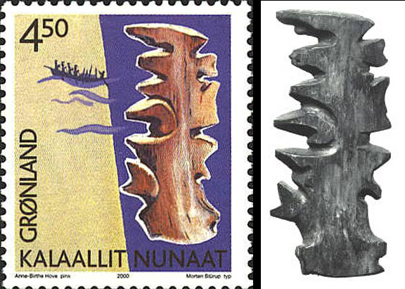
Inuit Wood Map, to be more precise, from Kalaallit Nunaat... that's Greenland to most of us.

Not exactly a AAA TripTik, and a far cry from Google maps, although still a cut above MapQuest.
It doesn't look very detailed, does it, well, there's a reason for that...
Quote:
|
These Inuit charts were usually carved from driftwood and are made to be felt rather than looked at. The Inuit hold this map under their mittens and feel the contours with their fingers to discern patterns in the coastline. The land is very abstract. It is limited to “edges” that can be felt on a dark night in a kayak. Since they are made of wood they are impervious to the weather, and will float if they are dropped overboard accidentally. It will also last longer that one that is printed.
|
See, practical, functional, and close enough in detail.
 link
link