xoB finds this beautiful image at
NASA's Earth Observatory. The explanation:
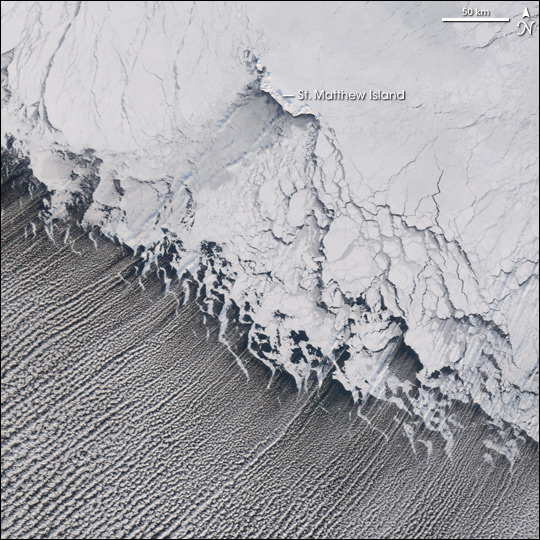
<i>Like the freshly raked white sand of a well-tended Japanese garden, rows of clouds stream over the Bering Sea from the edge of the sea ice. Called cloud streets, these cumulus clouds form when cold air from the ice blows over the open ocean, chilling the moist air. As the temperature drops, water freezes into tiny clouds, which are arranged in neat rows in line with the powerful sweep of the wind.</i>
But what makes it really amazing as an image, is that it's here on Earth yet resembles nothing you've ever seen before. It looks like a model, looks tiny. But check the scale - a fingerwidth on that image is 50km. So you're looking at a huge area in that shot.

 02-07-2006, 03:25 PM


 Threaded Mode