These days, when you take a photo, your camera will save all sorts of useful information inside the photo. GPS-enabled cameras -- even the iPhone -- are even equipped to save the location where the shot was taken.
Working at Cornell, research David Crandall and a team collected this locational information from 35 million flickr photos. (Most of these photos were copyrighted, but we are assuming that the geographic information inside the photo is fair use.) They then plotted the locations -- and this is what they found. The maps appeared.
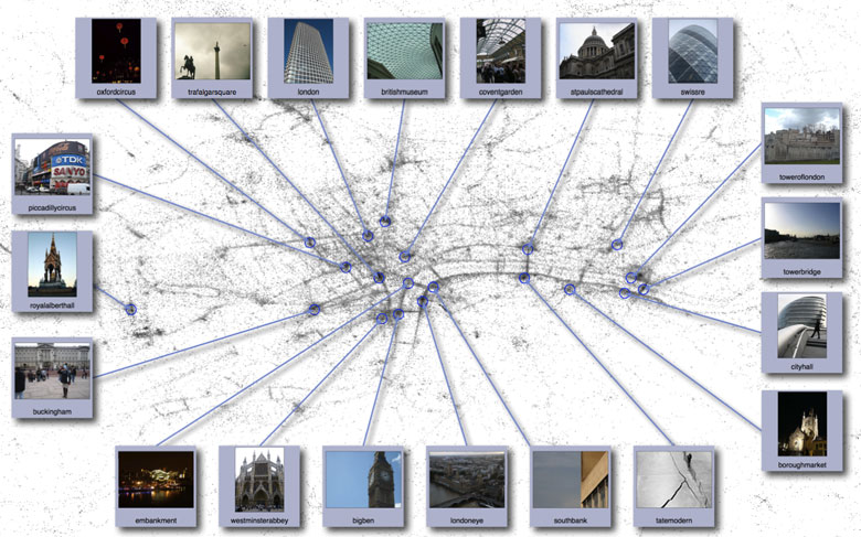
Above is the London version, striking for the outline of the Thames and its bridges. But on the
team's photomap page you can see they have generated maps of 5 continents/countries and 8 cities, and all are pretty interesting. They're very reminiscent of the "Earth at Night" which we enjoyed so much, except that we're not seeing light, we're seeing attention! They've also located the most-photographed places, reminding us all that if we take a holiday pic of the London Eye or Trafalgar, we are amongst millions doing so.

 04-28-2009, 12:08 PM


 Threaded Mode