
|
|
|||||||
| Image of the Day Images that will blow your mind - every day. [Blog] [RSS] [XML] |
|
|
Thread Tools | Rate Thread | Display Modes |
 05-11-2003, 12:23 PM
|
#1 |
|
Radical Centrist
Join Date: Jan 2001
Location: Cottage of Prussia
Posts: 31,423
|
5/11/2003: Shenandoah topography
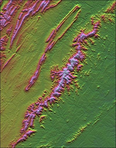 The Earth Sci pic of the day yields this nice one of Virginia's Shenandoah national park by Shuttle Radar Topography Mission data. Now here's the odd part: no camera was used to create this image. They recorded the various elevations in detail, via radar on the shuttle. Then they created this image from that data: one pass to create the shading (which areas are light and which dark) and one to create the color (different heights of the land get different colors). |

|

|
| Currently Active Users Viewing This Thread: 1 (0 members and 1 guests) | |
|
|


 Threaded Mode